 vesseltracker.com
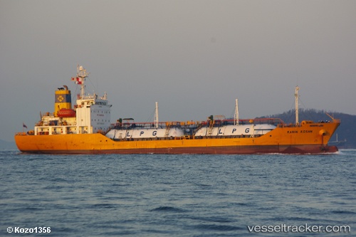
Vessel MAYA GAS 1 IMO: 9172753, MMSI: 620999533 Tanker
UTC, 25.33391, 56.49605, course: 109, speed: 4.7
UTC, 25.29340, 56.70465, course: 120, speed: 8.5
2026-03-04 18:16:56 UTC, 25.23695, 56.92030, course: -1, speed: 1.1
Live Vessel MAYA GAS 1 Analytics (details, animations, etc.)
Live AIS position: UTC. 14 nm E of Offshore Fujairah), updated 2026-03-04 18:16:56 UTC.Find the position of the vessel MAYA GAS 1 on the map. The latter are known coordinates and path.
marine traffic ship tracker show on live map
The current position of vessel MAYA GAS 1 is 25.23695 lat / 56.92030 lng. Updated: 2026-03-04 18:16:56 UTCCurrently sailing under the flag of Comoros
Details:
Last coordinates of the vessel:
UTC, 25.33647, 56.49256, course: 122, speed: 0.1UTC, 25.33391, 56.49605, course: 109, speed: 4.7
UTC, 25.29340, 56.70465, course: 120, speed: 8.5
2026-03-04 18:16:56 UTC, 25.23695, 56.92030, course: -1, speed: 1.1